72 DPI JPG (396 Kb)
300 DPI JPG (8.4 MB)
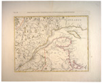
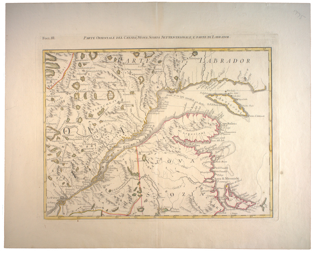
Zatta, Antonio, fl. 1757-1797. Parte orientale del Canadá , Nuova Scozia settentrionale, e parte di Labrador. -- Scale [ca. 1:2 100 000] (W 73º00'--W 60º00'/N 51º15'--N 46º00'). -- [Venice : Presso Antonio Zatta, 1778].
1 map : hand col. ; 31 x 42 cm.
LOCATION: G3300 1778 Z37 fogl.3 RBD Map

72 DPI JPG (249 Kb)
300 DPI JPG (6.4 MB)
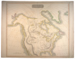
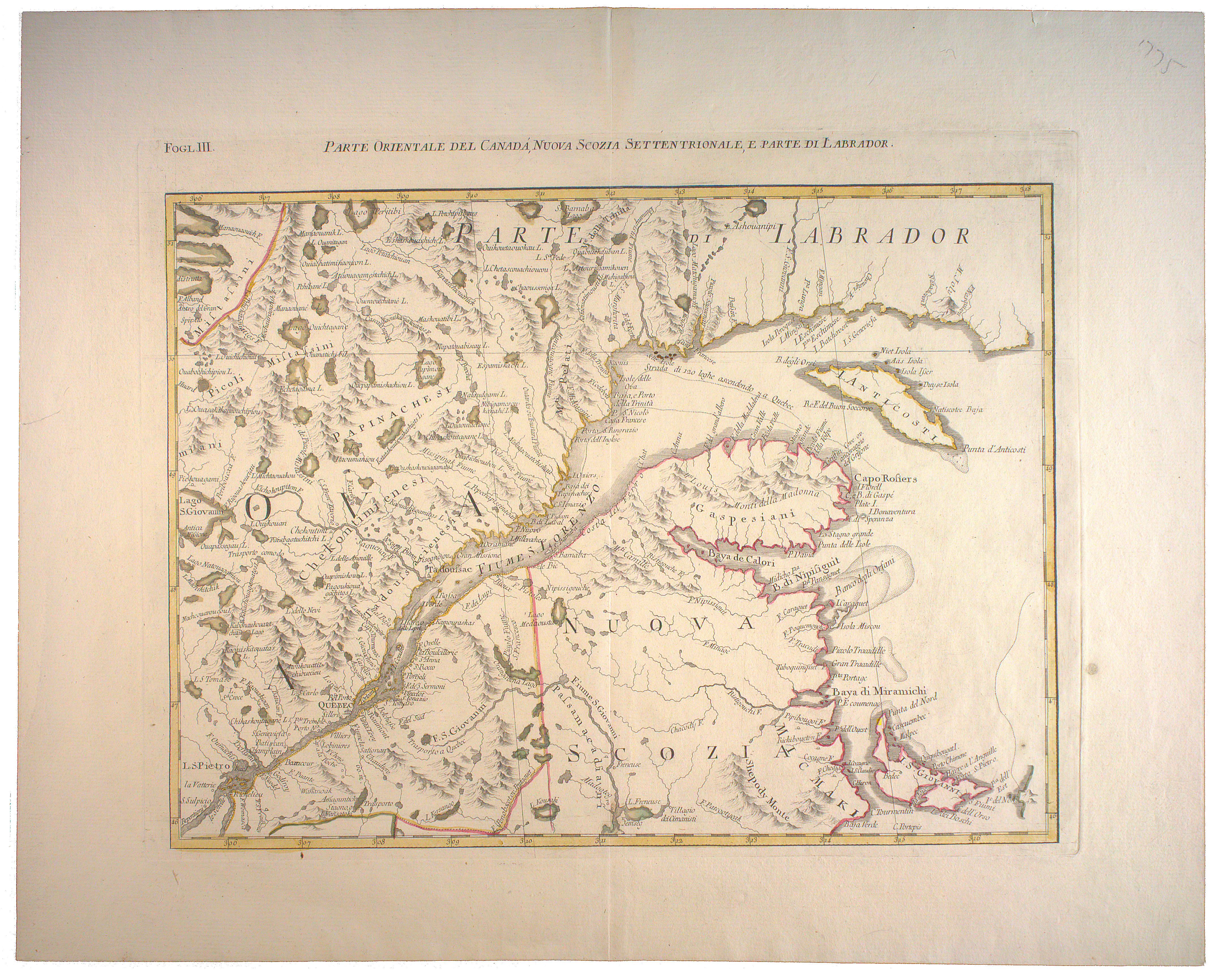
Lescarbot, Marc, 1570?-1630? Figure de la Terre Neuve, Grande rivière de Canada, et Côtes de l'Océan en la Nouvelle France / Marcus Lescarbot, nunc primum delineavit. -- Scale indeterminable. -- [178-?].
1 ms. map ; 43 x 67 cm.
LOCATION: G3402 S3 1609 L3 1780z RBD Map
72 DPI JPG (424 Kb)
300 DPI JPG (4.7 MB)
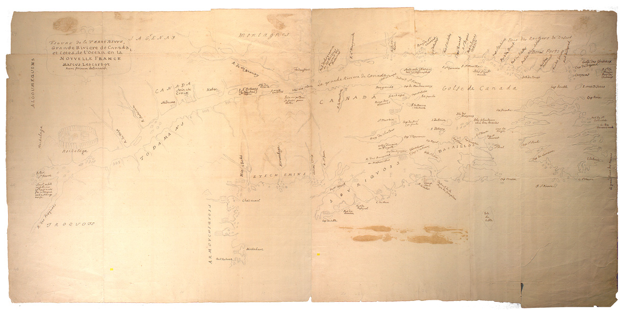
Wilkes, John, 1727-1797. British Colonies in North America / London, Pub. as the Act directs May 20th 1797 by J. Wilkes. -- Scale [ca. 1:20 000 000] (W 132º--W 27º/N 80º--N 40º). -- London : J. Wilkes, 1797.
1 map : hand col. ; 23 x 18 cm.
LOCATION: G3300 1797 W54 RBD Map
72 DPI JPG (354 Kb)
300 DPI JPG (8.2 MB)
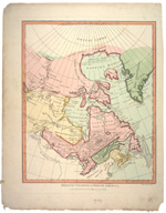
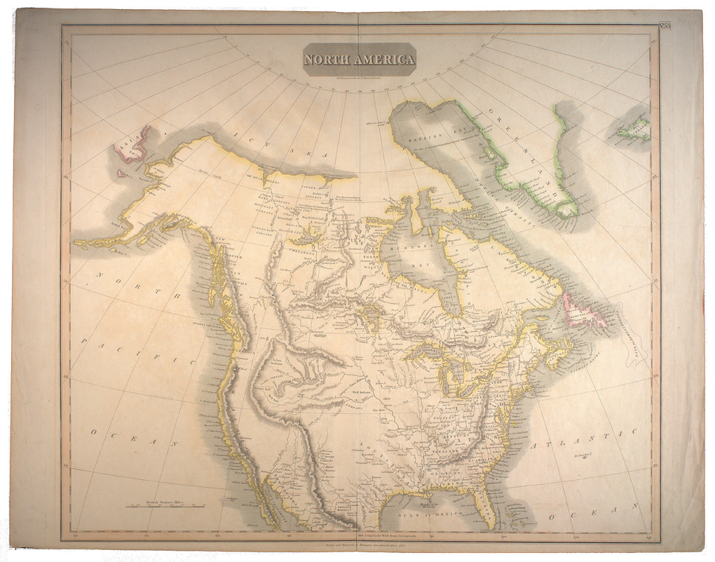
Thomson, John, 19th cent. North America / drawn and engraved for J. Thomsons New General Atlas 1814. -- Scale [ca. 1:13 000 000] (W 30º--W 190º/N 80º--N 24º). -- Edinburgh : J. Thomson, 1814.
1 map : hand col. ; 50 x 60 cm.
LOCATION: G3300 1814 T46 RBD Map
72 DPI JPG (371 Kb)
300 DPI JPG (5.1 MB)
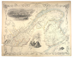
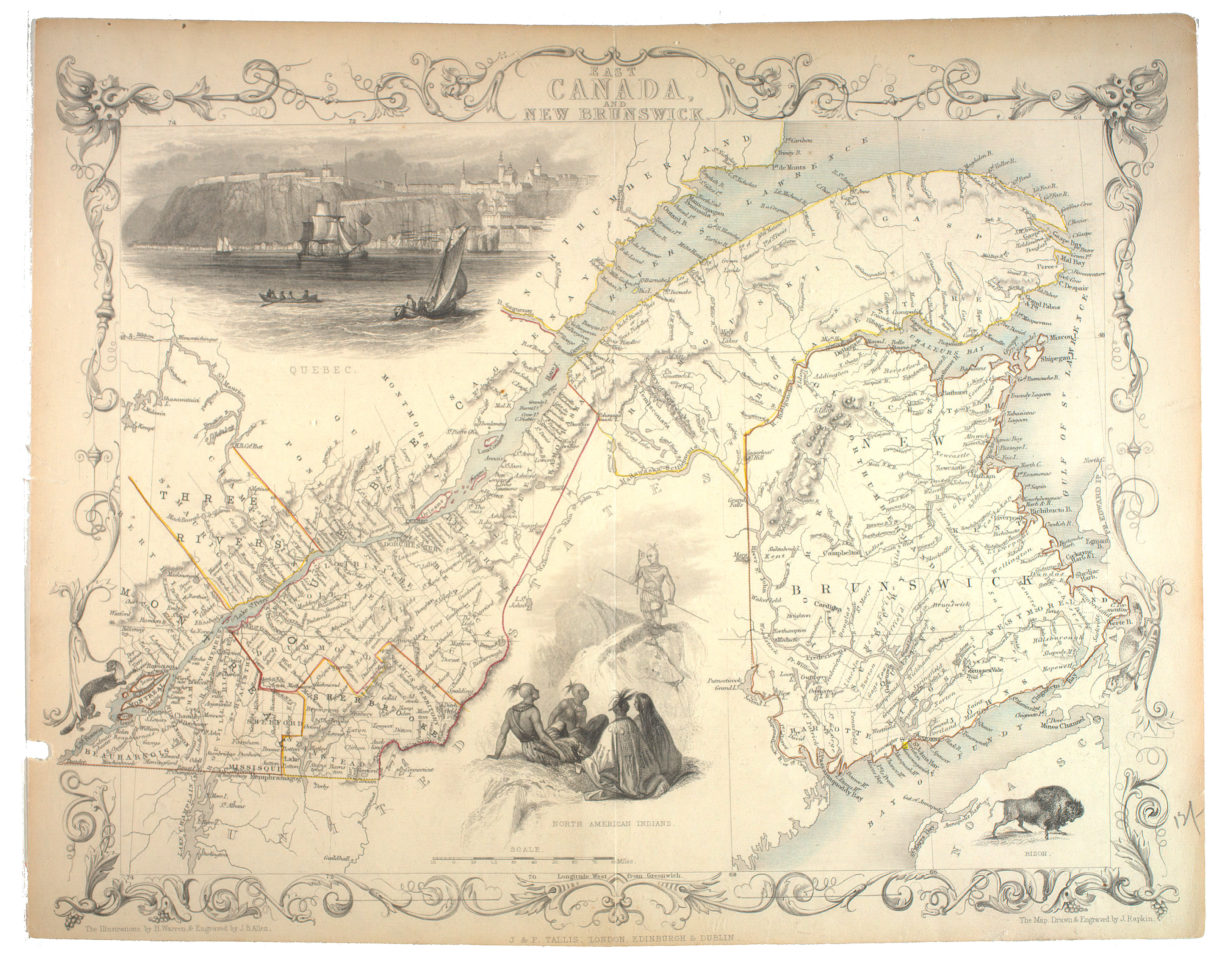
Rapkin, John, fl. 1845-51. East Canada and New Brunswick / the map drawn & engraved by J. Rapkin ; the illustrations by H. Warren & engraved by J.B. Allen. - - Scale [ca. 1:2 661 120] (W 74º--W 64º/N 48º--N 46º). -- London [England] ; Edinburgh ; Dublin : J. & F. Tallis, [1857?].
1 map : hand col. ; 22 x 30 cm. on sheet 28 x 35 cm.
LOCATION: G3402.S3 1857 R3 RBD Map
