
72 DPI JPG (547 Kb)
300 DPI JPG (11.1 MB)
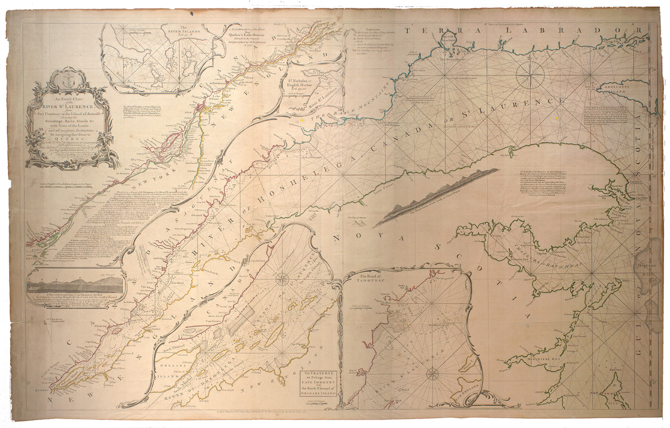
Jefferys, Thomas, d. 1771. An exact chart of the river St. Laurence : from Fort Frontenac to the island of Anticosti shewing the soundings, rocks, shoals &c with views of the lands and all necessary instructions for navigating that river to Quebec / by their lordships most obedient most devoted humble servt Thos. Jefferys. -- Scale [ca. 1:695 000] (W 76º30'--W 64º00'/N 50º25'--N 44º00'). -- London: Robt. Sayer, map & printseller, 1775.
1 map : hand col. ; 60 x 95 cm.
LOCATION: G3312 S5P5 1775 J4 RBD Map
72 DPI JPG (377 Kb)
300 DPI JPG (8.4 MB)
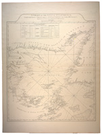
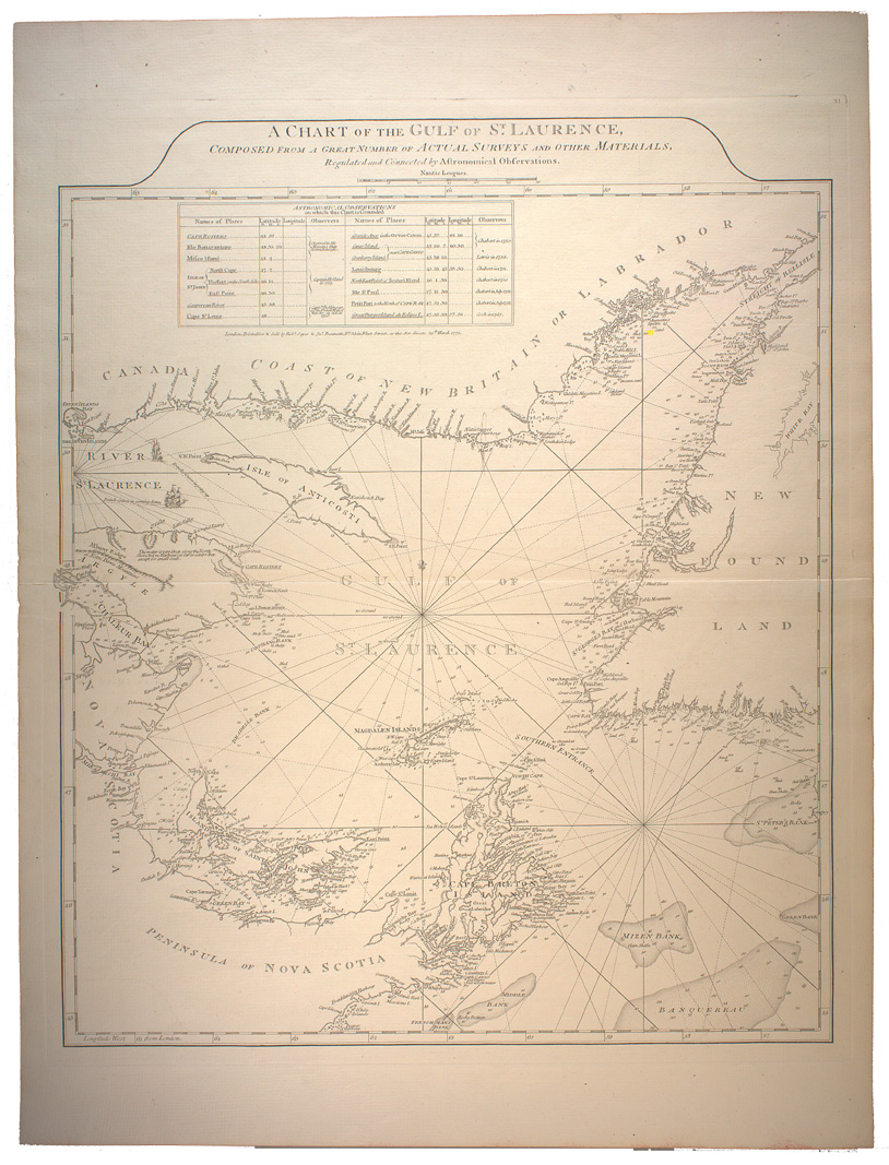
Jefferys, Thomas, d. 1771. A chart of the Gulf of St. Laurence : composed from a great number of actual surveys and other materials, regulated and connected by astronomical observations. -- Scale [ca. 1:500 000] (W 67º--W 56º/N 52º--N 45º). -- London : Printed & sold by Robt. Sayer & Jno. Bennett, 1775.
1 map : hand col. ; 57 x 49 cm.
LOCATION: G3402.S2 P5 1775 J43 RBD Map

72 DPI JPG (454 Kb)
300 DPI JPG (9 MB)
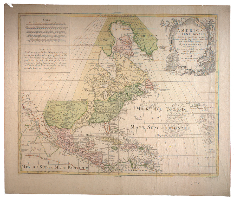
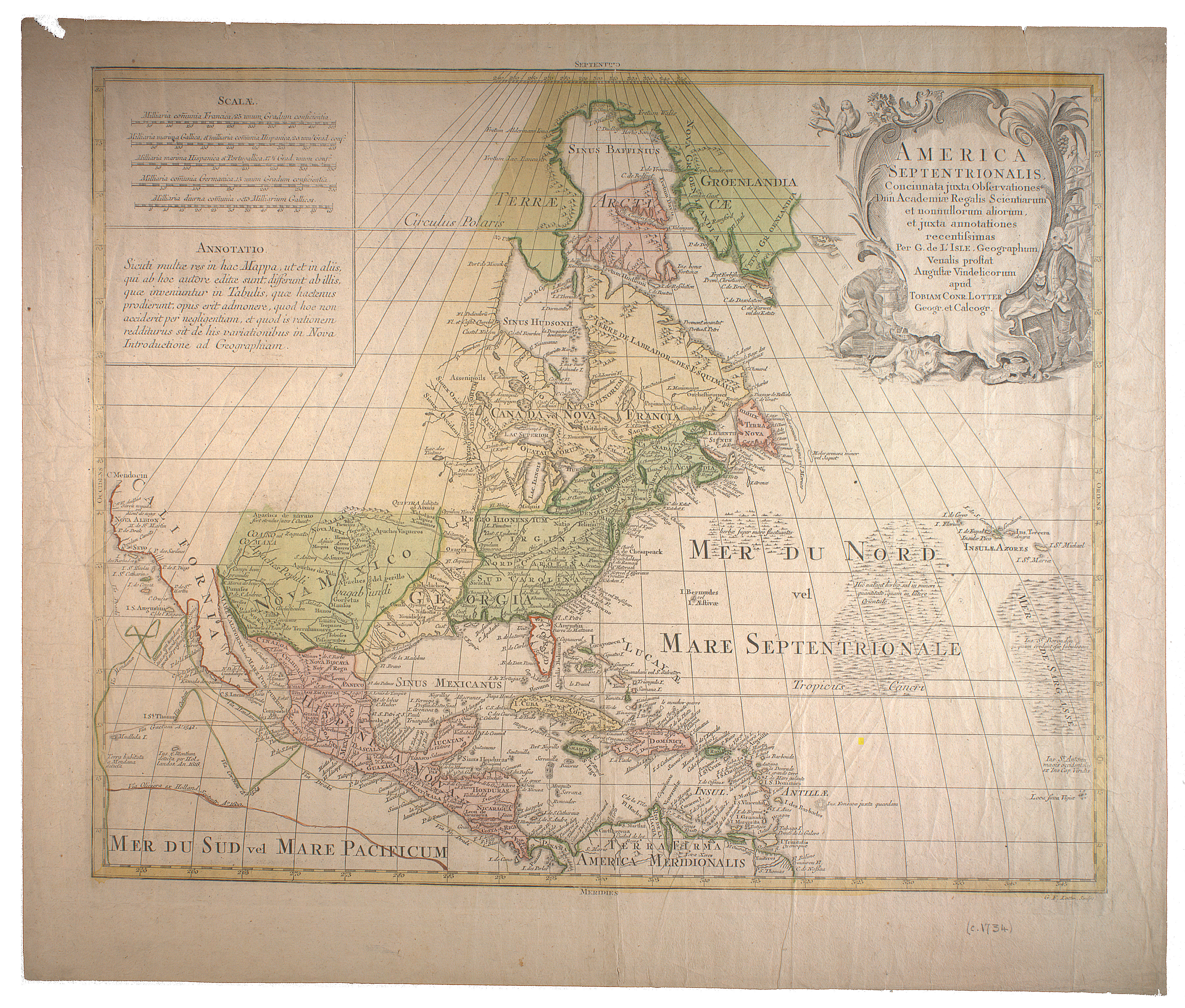
Lotter, Georg Friedrich. Ameörica Septentrionalis : concinnata juxta observationes Dnn Academi' Regalis Scientiarum et nonnullorum aliorum, et juxta annotationes recentissimas / per G. de L'Isle, geographum. Venalis prostat August' Vindelicorum apud Tobiam Conr. Lotter, geogr. et calcogr. -- Scale [ca. 1:18 750 000]. -- Augsburg : Tobias Conrad Lotter, [1778?].
1 map : hand. col. ; 45 x 58 cm.
LOCATION: G3300 1778 L6 RBD Map
72 DPI JPG (456 Kb)
300 DPI JPG (8.8 MB)
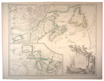
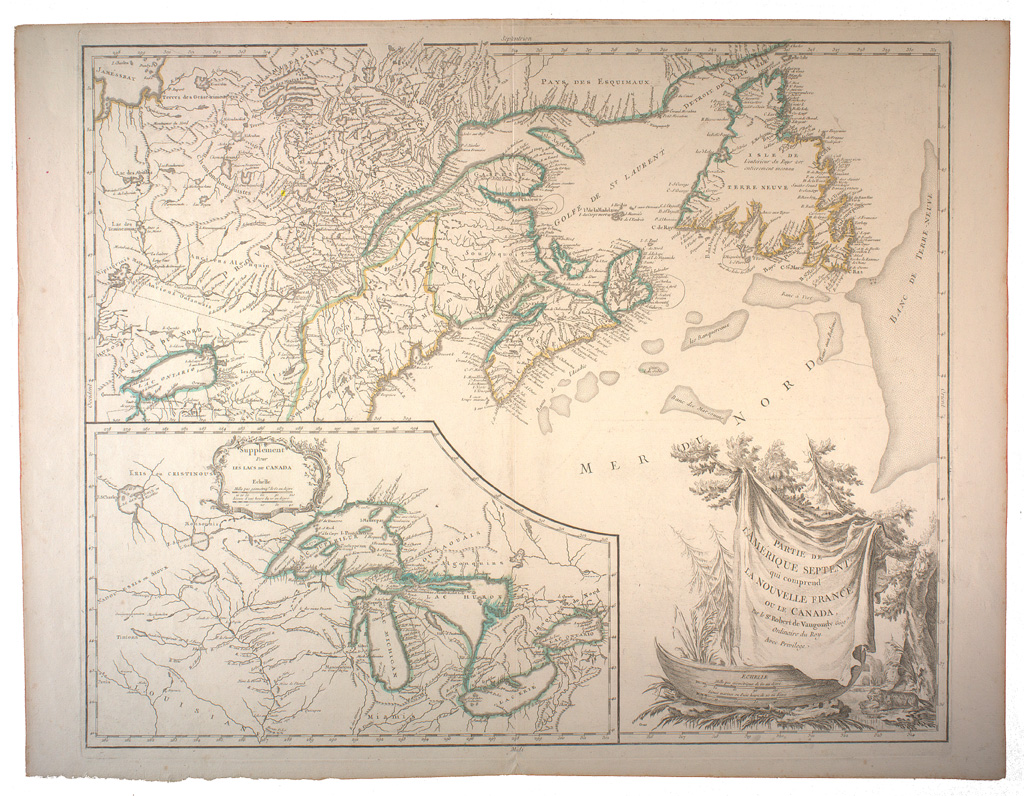
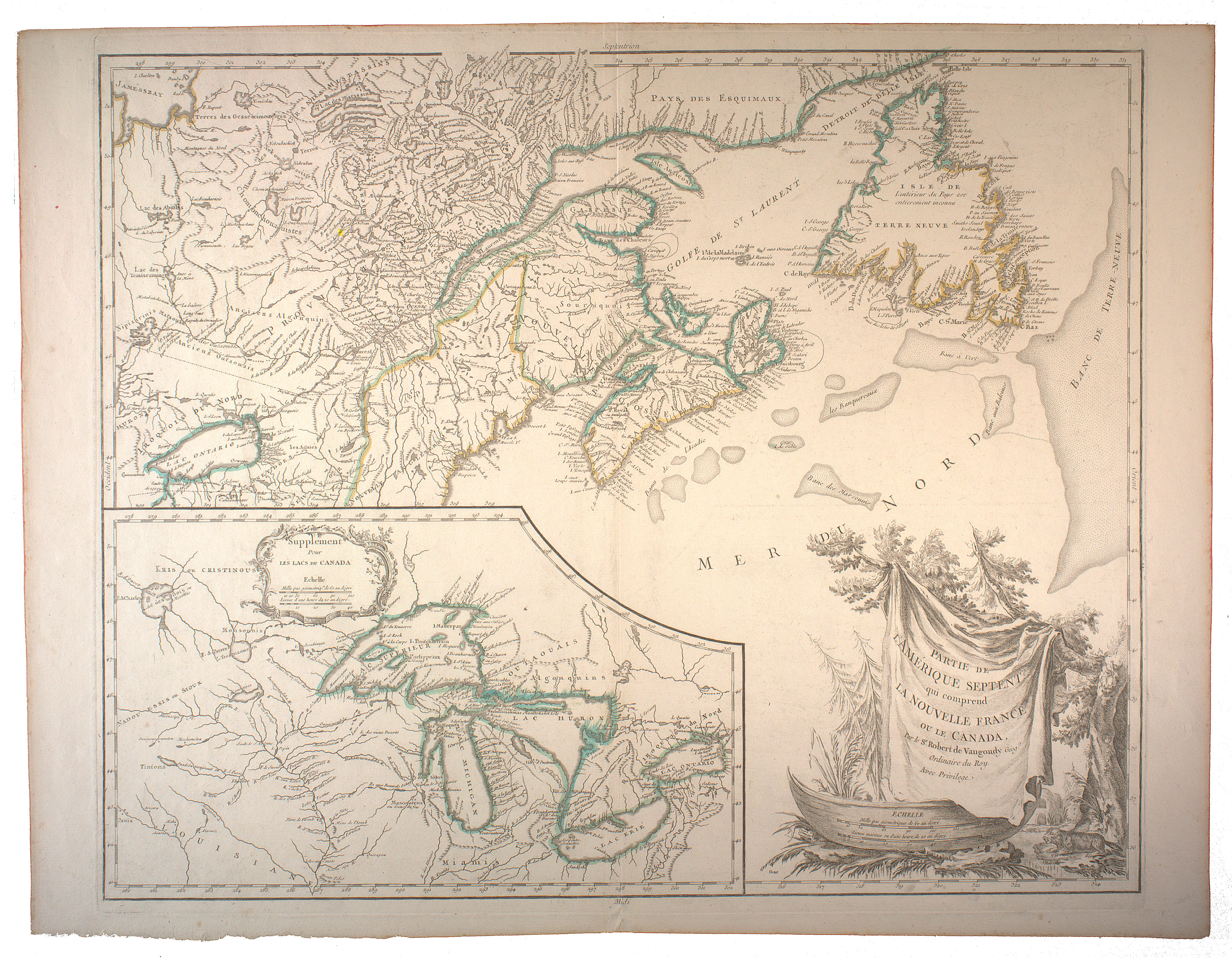
Robert de Vaugondy, Gilles, 1688-1766. Partie de l'Amérique septent? qui comprend la Nouvelle France ou le Canada / par le Sr. Robert de Vaugondy, géog? ordinaire du roy. Avec privilege ; Groux. -- Scale [ca. 1:4 000 000]. -- [Paris : Chez l'auteur, 1778].
1 map : hand col. ; 48 x 61 cm.
LOCATION: G3402.S3 1778 R6 RBD Map
72 DPI JPG (400 Kb)
300 DPI JPG (8.3 MB)
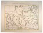
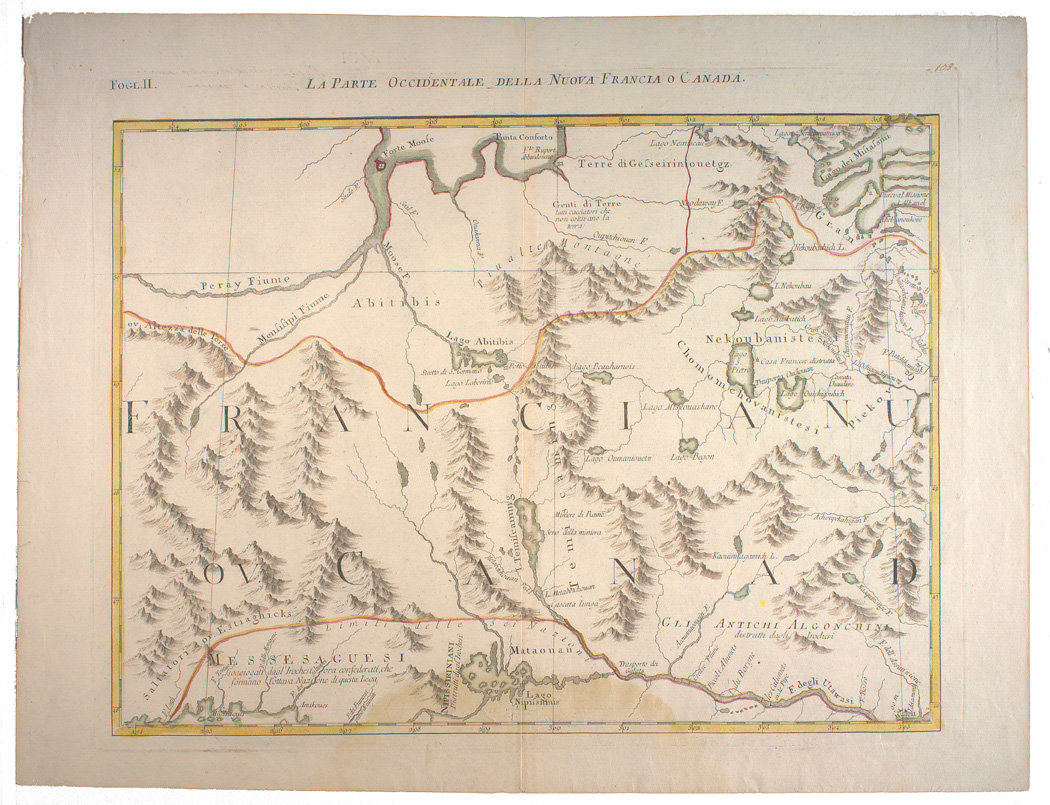
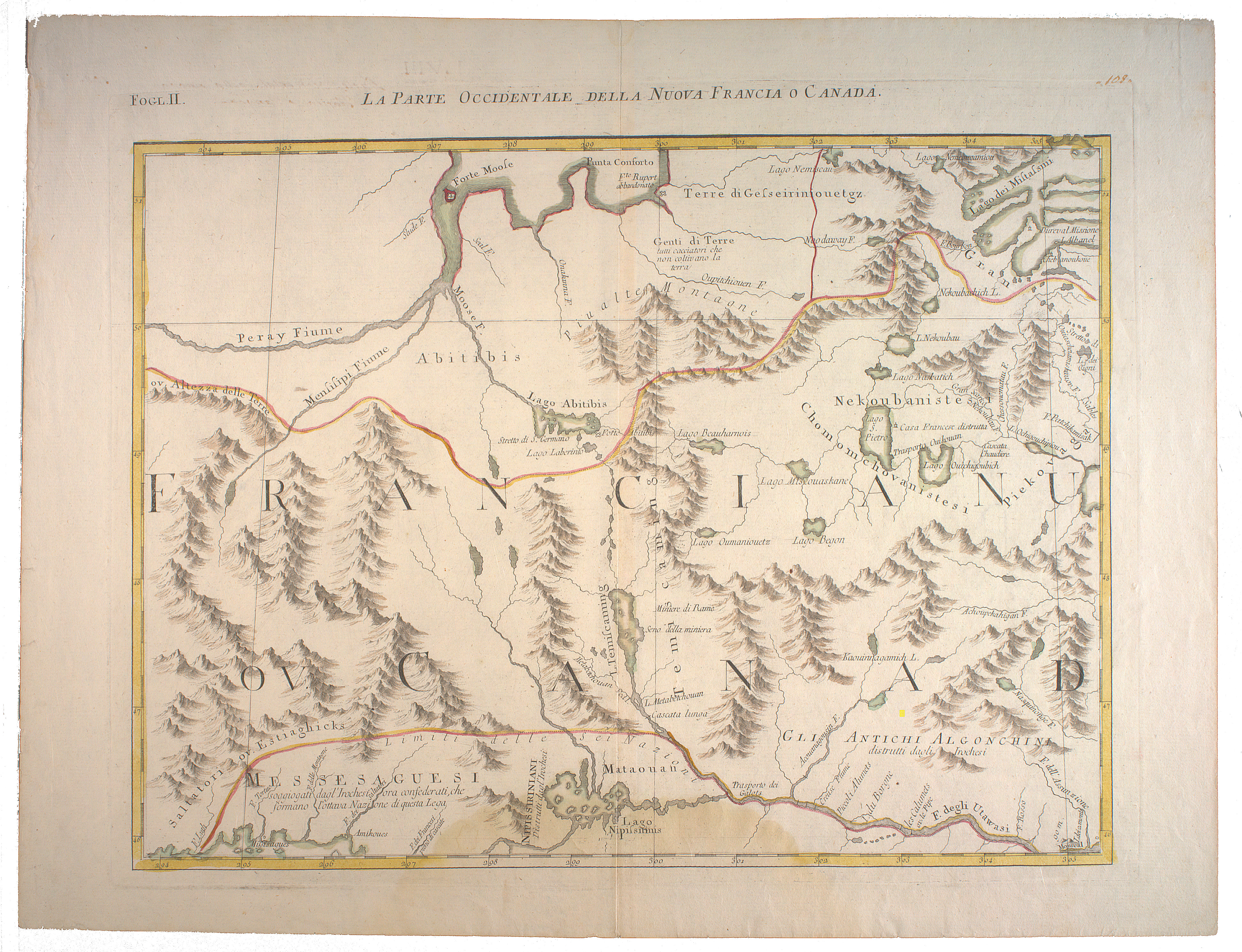
Zatta, Antonio, fl. 1757-1797. La parte occidentale della Nuova Francia o Canada. -- Scale [ca. 1:2 100 000] (W 86º--W 73º/N 51º--N 46º). -- [Venice : Presso Antonio Zatta, 1778].
1 map : hand col. ; 31 x 42 cm.
LOCATION: G3300 1778 Z37 fogl.2 RBD Map

