|
Historical Maps Related to the Explorations and Territories Discovered and Claimed
By the North West Company.
Map 1: Map of the North-West Territory of the Province Canada from actual Survey During the Years 1792 to 1812.
This Map made for the North West Comapny in 1813 and 1814 and delivered to The Honorable William McGillivray then Agent Embraces the Region lying between 45 and 60 degrees North Latitude and 84 and 124 degrees West Longitude comprising the Surveys and Discoveries of 20 years namely the Discovery and Survey of the Oregon Territory to the Pacific Ocean the survey of the Athabasca Lake. Slave River and Lake from which flows Mackenzies River to the Arctic Sea by Mr. Philip turner The Route of Sir Alexander Mackenzie in 1792 down part of Frasers River together with the Survey of this River to the Pacific Ocean by the late John Stewart of the North West Company by David Thompson Astronomer and Surveyor.
Source: Musée McCord Museum Accession Number: M5455 Map 2: Map Depicting the Principal Trading Stations of the North West Company in 1817. Notice Respecting the Boundary Between His Majesty's Possessions in North America and the United States; with A Map of America, between Latitudes 40° and 70° North, and Longitudes 80° and 150° West; Exhibiting the Principal Trading Stations of the North West Company; and Intended to Accompany the Narrative of Occurences in the Indian Countries of North America, Connected with The Earl of Selkirk, The Hudon's Bay and the North-West Companies. London: Printed By B. McMillan, Bow-Street, Covent-Garden, 1817. &ldquot;Referring to the Extracts herewith given of the Treaties of 1783, 1794, and 1814, it is not intended to comment upon the manifest geographical ignorance of the British Negociators in the former of these Treaties, nor to enlarge upon the important, and now irrecoverable, territorial advantages which they yielded to the Americans, without obtaining any acknowledgement or equivalent in return: this Notice is meant merely to describe the boundary line now claimed by the United States, and to explain the grounds upon which their claims appear to be founded.&rdquot; Source: Rare Books and Special Collections Division, McGill University Libraries. McGill University Map 3 Sketch of Part of the Hudson's Bay Company's Territory. Drawn and Engraved by A. Arrowsmith, 10 Soho Square Lond 12.th February 1817. Map included with Statement Respecting The Earl of Selkirk's Settlement upon the Red River in North America; Its Destruction in 1815 and 1816; and the Massacre of Governor Semple and His Party. With Observations upon a recent publication, entitled &ldquot;A Narrative of Occurrences in the Indian Countries,&rdquot; &c. London: John Murray, Albemarle Street, 1817. Source: Rare Books and Special Collections Division, McGill University Libraries, Montreal, Quebec. |
 Map 1 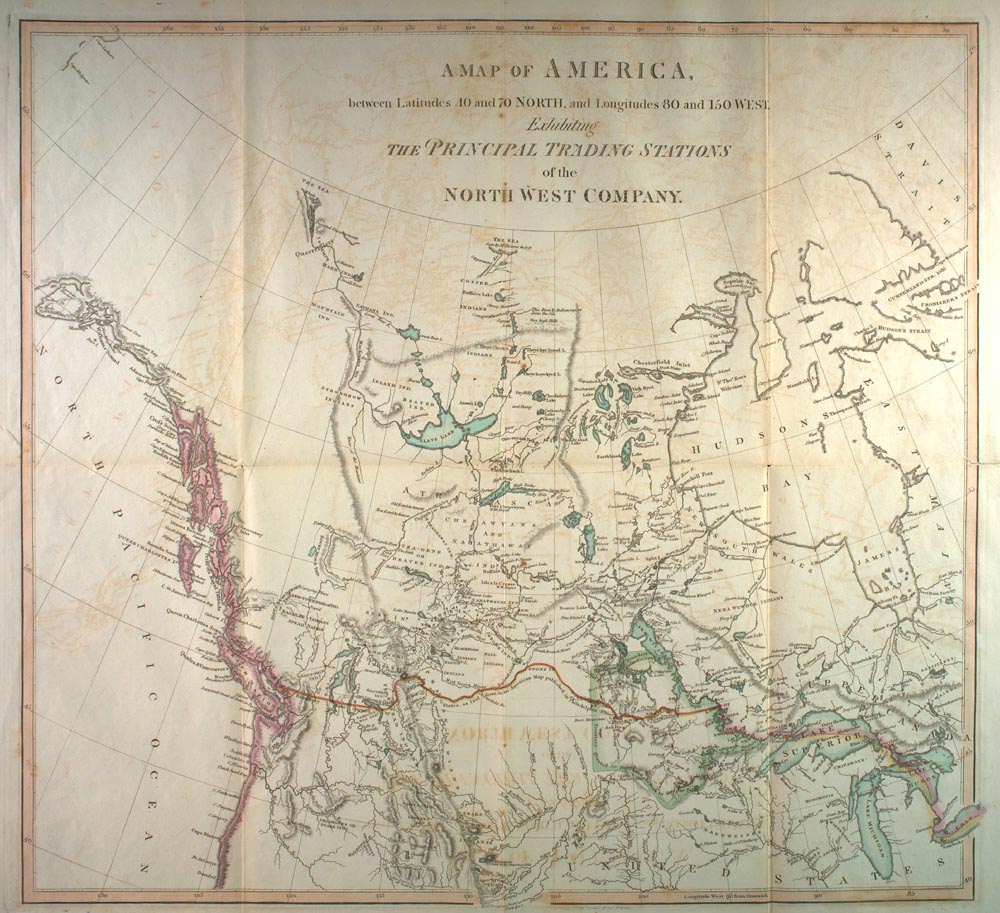 Map 2 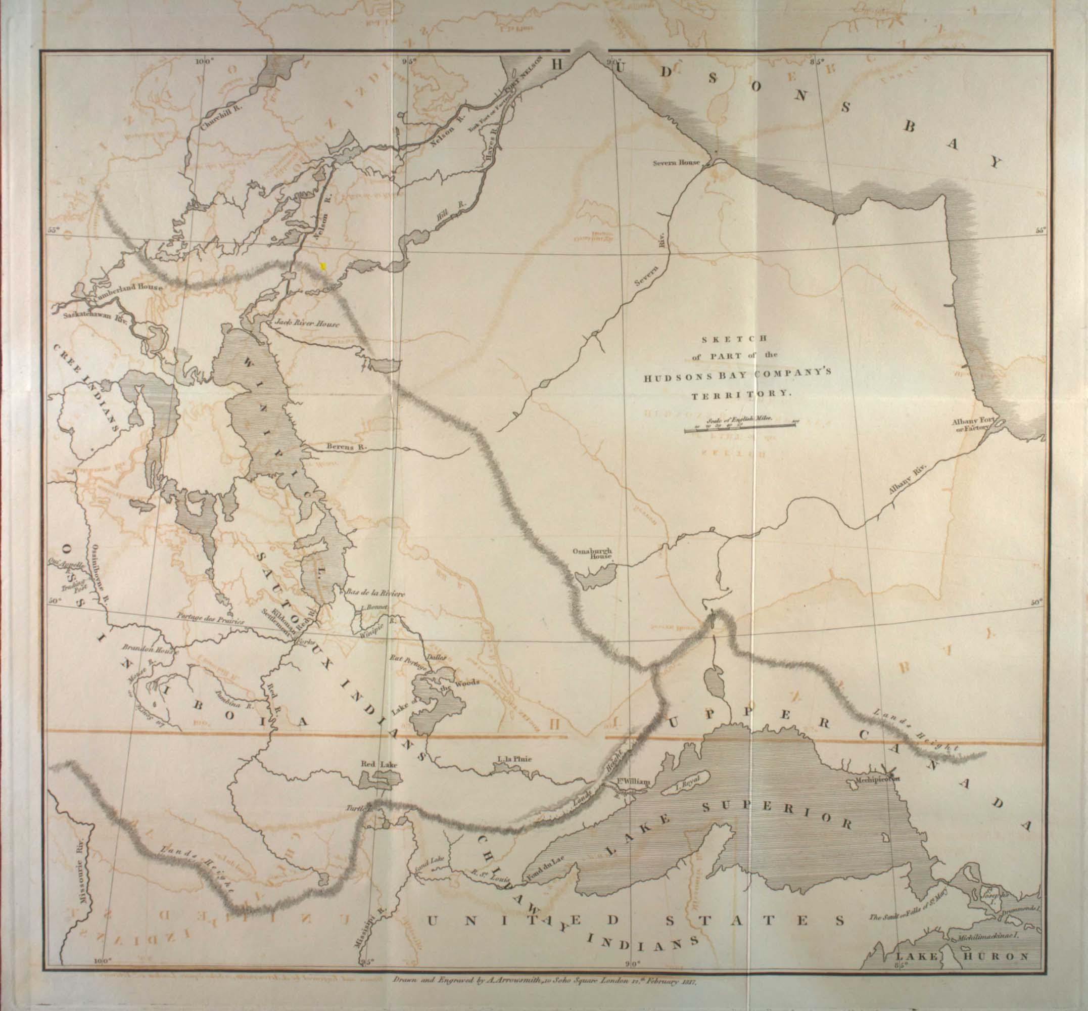 Map 3 |